|
The Tauredunum Event
“A great wonder appeared in Gaul at Fort Tauredunum, located on the river Rhone on the side of a mountain. For more than sixty days an indescribable roar was heard, then eventually a mountain fractured and separated from the next, collapsing into the river, carrying people, churches, property and houses. The river course became blocked and the water flowed backwards, flooding the area upstream, inundating and destroying everything on the banks”. History of the Gauls, Gregoire de Tours, 563.
The Gallic Celtic people who lived in and around the Chateau de Tauredun, in the Chablais, at the head of Lake Geneva, in what is now Canton Vaud, Switzerland were probably related, by dint of geography, to the La Tène people of Neuchatel 100 kilometers away, and perhaps also by ancestral culture, deeply connected to the people who painted the cave art at Lascaux around 19,500 years ago. As the Bronze Age gave way to the Iron Age in Switzerland, the Celtic tribes who circulated from Gaul east to the alps and westward to Britain, formed travel connections and relations, by language, and trade in metals and salt, ornaments, implements and artefacts. They formed ties of kinship, and bonds of commerce and friendship throughout the territories of the Celtic tribes through alliance with the people of ancient Gaul, and Helvetia, the Swiss plateau. These people lived on the alluvial plain of the Upper Rhone Valley on the ancient trade route that connected the great mountain passes from northern Italy, facilitating the trade between the ancient civilizations with Gaul and Britain.
Like the rest of the Celtic world, they developed intricate geometric art based on precise measurements, and diffused and propagated their knowledge of astronomical events such as solstices and equinoxes, both as oral record, and in the mathematics of the design of artefacts. They left gold plaques, mirrors, urns, ornaments and other artworks in precious metals, with intricate engravings. They recorded solstices, and transport directions in the alignment of their public buildings, as well as in their trade and communication networks, making contacts and exchanging information, not only with Celtic tribes over vast tracts of western Europe, but also with the people south of the alps, the Greeks and Etruscans. The brilliant La Tène culture of the late Iron Age extended from the western Iberian peninsula, throughout Gaul (modern France) and Helvetia (the Swiss plateau), west to Britain and Ireland, across southern Germany and east throughout Austria.
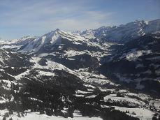
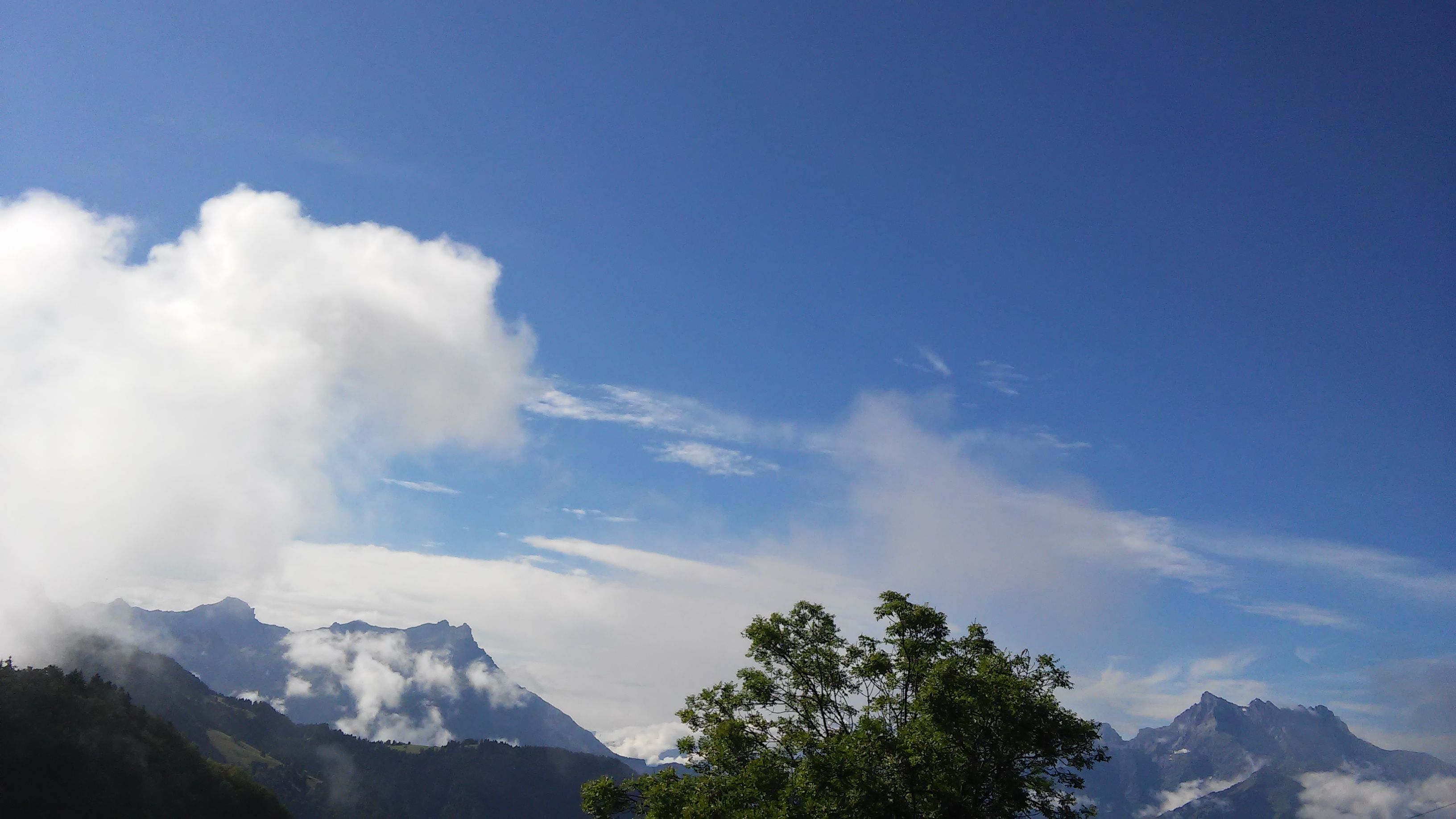
The alps of Helvetia, ancient name for Switzerland, hide their own secrets. To anyone who has stood and admired their magnificence, they clearly have some fascinating tales to tell, of lives and liberty, of tribulations and courage, as well as the sheer power and beauty of rock formations pushed up from deeper geological layers. The mountains originated from clouds of cosmic dust, generated in stars, and blown off by winds and stellar explosions, made of hard refractory minerals when the solar system was born around 4.5 billion years ago.
The ancestors weathered a very interesting series of historical events, when their civilized world was interrupted by a highly organized, opportunistic band of wealthy Romans, who, not content with the riches gathered from their own regions, conquered and colonized, and grew wealthier by force and enslavement of other tribal territories. Roman incursions into the Celtic Gallic tribal territory and finally conquest, was followed by the dark ages, the rise and fall of feudalism, and the forging of the republic of free men and women. How on Earth did these people survive? What motivated them to conserve their freedom by finding new places to inhabit, rather than subject themselves to tyranny? When and why did people begin to inhabit the wild valley populated by lynxes, wolves and bears, with freezing winter temperatures, off the beaten tracks that existed at the start of our modern era. And what lessons can we learn from the ancestors, to apply to the greatest moral challenge humanity has ever faced, climate change.
When the Savoyards finally colonized the Ormonts Valley around the 12th century, the family Tardent, French speaking people until they became polyglots in the 19th and 20th centuries, were present, found in early accounts of modern Swiss history. The French pronunciation is identical to Tauredun, or Tauredunum as it was known at the time of Gregoire de Tours, and Marius d’Avenches, monk historians of the sixth century. A town, once a fortified settlement with roots in the Iron Age, was completely destroyed by the collapse of the mountain above it, with such violence that it collided with the neighbouring escarpment, crushing the chalets, people, goods, chattels and animals under thousands of tons of rock. Those who were not buried were swept away by the flood.
The event not only took out the inhabitants of the Tauredun settlement, but also the villages above and below, on the Rhone plain, either drowned by the backing up of the Rhone as its course was blocked by massive slabs of rock, or by the huge wall of water that found its way through the blockage, roaring like a train to engulf the villages in its path, as the Rhone became a tsunami, a torrent that swept everything in its path on the banks of Lake Leman, all the way to Geneva over 50 kilometers away. This was an event of seismic proportions, both figuratively and literally, as the 60 days of rumbling by the mountain before its fall must have been related to a subterranean shifting of the rock mantle girding the Earth, to have caused such a dramatic collapse. An event that is irrefutable in early European history, it was recorded independently twice in the sixth century. Recent explorations of the bed of Lake Leman, the lake of Geneva, indicate that similar, though not as massive events occurred in the Bronze Age, roughly 3,800 years ago, according to dating of remnant vegetation.
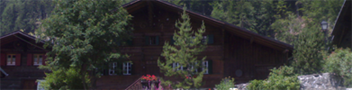
The original site of Tauredunum has been determined by archaeologists and geologists, on what was a strategically sited hilly plateau above the fertile Rhone plain at the head of the lake of Geneva. One geological survey dovetails almost exactly with the account of Gregoire de Tours, and this means that despite the devastation, there were eye witnesses on higher ground who observed the event. It is comforting to think that some inhabitants realized that a loud rumbling from a mountain over an extended period of time was a clear signal to decamp to safer ground, hopefully in time to take with them, their household belongings, animals, and eventually, the name. The family has been writing its history since the end of the 18th century, out of general interest, and as part of a habit of record keeping from earlier mountain chatelains since the 15th century, responsible for the establishment and keeping of communal records in the Ormonts Valley, that runs into the Upper Rhone Valley, not far from the head of the lake. An historical account by Henri Tardent provides some illuminating nineteenth century French Swiss political, historical and environmental insights.
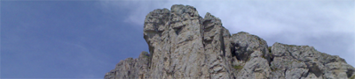
On the Celtic road network, underneath Les Dents du Midi, a late Iron Age Oppidum, the chef-lieu of the Nantuaten, Taranais dunum, probably had its fortifications improved between the first attempt and the successful Roman invasion in 15 BCE. Buried in the pre 563 moraine, four Bronze Age bracelets were found at the level of the identified site of the settlement before the landslide destroyed it. By the sixth century the Romanized name was Tauredunum or Tauredun. This fortress was built just above the river plain, where there was once a low but defensible plateau under the towering, majestic Dents du Midi. That it was the original site of the chef-lieu of the Nantuaten, Taranais, is well borne out by archaeological finds. It must have grown over the centuries, and it was located just above Massongex, a couple of kilometers from the current site of Saint Maurice, where the Romans had preferred to develop their administrative center, Agaunum. The location is on the edge of the old Nantuaten territory boundary, an excellent location to control trade through the narrow corridor sandwiched between Les Dents du Midi and Dent de Morcles.
Celtic toponymy, the study of place names wholly or partially of Celtic origin identifies ‘dunum’ as a derivation of the Celtic dunon or 'fortress'. Europe is scattered with places whose second part is the Romanized ‘dunum’. For example Lugdunum was the fortress of Lug, the God of Light. Tarnaias was a Nantuaten stronghold, and ‘dunum’ may refer to the fortifications built to counter the threat of Roman invasion. A strategic location, it held out against the original Roman army invasion for a negotiated settlement. Probably Tarnaias was Taranis, in Celtic mythology, the god of thunder, essentially worshipped in Gaul. This would make sense as a place name, as during the hot summer months, violent thunderstorms can rage around the surrounding mountains. As geological detective work has placed the course of the Rhone much closer to Les Dents du Midi before the seismic event, it is likely that the settlement was strategically located on the hillside above the river that flowed below it.
The fall of the mountain, dislodging and burying not only the fortress and its surrounding dwellings, but also all the nearby habitations in the year 563, was an event of momentous proportion. It caused a tidal wave that eventually swamped Geneva, engulfing the settlements on both banks of Lake Leman. The Tauredunum event was of such magnitude that it was recorded not once, but twice, independently and separately, by the two western European monk historians of the age. Tarnaias was on the south side of the Rhone. One of the pieces of the jigsaw for the original location of Tarnaias (which by 563 became Tarnaias dunum, or Tauredunum) was the finding of the remains of the limestone blocks that collapsed at the same time as the mountain above it. The blocks formed the abutments of the Roman bridge across the Rhone, and were discovered in 1976 in the bed of the Rhone at Massongex, by a mechanical digger extracting gravel. They would have been deposited there by the unleashing of the tidal wave, following the landslide of Les Dents du Midi. The bridge, in 563, would have crossed the Rhone at a strategic place where the river was narrow, and the ground firm enough to support the monumental structure of stone. The fortress was thus located close to the narrow passage of the Rhone adjacent to the negotiated boundary between the territory of the Nantuaten and the Veragri, whose tribal capital at Octodurum, was a mere fifteen kilometers or so further upstream along the Rhone.
Saint Maurice was originally called Agaunum, and the name does come from the Gaulish language, originally meaning ‘stone’. The stone may refer to the large quantity of terminal moraine from the glacier deposited in the bed of the Rhone at this point, much of it swept away in 563. For both the Nantuaten and the Romans, it allowed the regulation of the travellers along the trade route over the Alps, and may well have been a lucrative source of revenue, perhaps an early customs post demanding duty to be paid on transported goods. The collapse must have been triggered by a major seismic event, as the adjoining mountain Grammont also suffered a massive rock avalanche in the same event. No doubt the whole plain must have been violently shaken. Yet not everyone heeded the warnings, even though the preliminary earthquake tremors made themselves heard preceding the landslides. The event was recorded in some detail by Gregory of Tours in his History of the Franks. He wrote:
‘Le Chateau de Tauredun: A great prodigy appeared in Gaul at the fortress of Tauredunum, which was situated on high ground above the River Rhone. Here a curious bellowing sound was heard for more than sixty days: then the whole hillside was split open and separated from the mountain nearest to it, and it fell into the river, carrying with it men, churches, property and houses. The banks of the river were blocked and the water flowed backwards. This place was shut in by mountains on both sides, for the stream flows there through narrow defiles. The water then flooded the higher reaches and submerged and carried everything which was on its banks.
A second time the inhabitants were taken unawares, and as the accumulated water forced its way through again it drowned those who lived there, just as it had done higher up, destroying their houses, killing their cattle, and carrying away and overwhelming with its violent and unexpected inundation of everything which stood on its banks as far as the city of Geneva. It is told by many that the mass of water was so great that it went over the walls into the city mentioned. And there is no doubt of this tale because as we have said the Rhone flows in that region between mountains that hem it in closely, and being so closely shut in, it has no place to turn aside. It carried away the fragments of the mountain that had fallen and thus caused it to disappear wholly.’
Marius of Avenches also described the event in his Chronicle:
‘The great mountain of Tauretunum, in the territory of the Valais, fell so suddenly that it covered a castle in its neighbourhood, and some villages with their inhabitants; it so agitated the lake for 60 miles in length and 20 in breadth that it overflowed both its banks; it destroyed very ancient villages, with men and cattle; it entombed several holy places, with the religious belonging to them. It swept away with fury the Bridge of Geneva, the mills and the men; and, flowing into the city of Geneva, caused the loss of several lives.’
According to one scientific opinion, it would have been a magnitude six tremor to cause such a landslip. And the evidence shows that this was not the first time part of a mountain had fallen into the Rhone valley, there were several smaller falls before this event, which, researchers showed caused a wave, probably higher than six meters to roar along towards the other end of the lake where Geneva is still situated today.
A tidal wave ravaged the banks of Lake Leman during the Bronze Age. Analysis of sediment on the bed of the lake reveals that around 1750 BCE, the people living on the banks of the lake also experienced an earth shaking event, leading to a sudden and violent eruption of a huge wall of water flowing along from the head of the lake. The result was a devastation of lake villages along the shores, subsequently abandoned. The cause of the wave was the backing up of the waters of the Rhone resulting from the slippage of the terrain and a massive rock fall from the towering mountains left over from the last glacial period, when the ice age gouged out the river valley. Techniques of geophysics were used for analysis, directed seismic energy, and the propagation of generated sound waves through the layers of the geological strata were used to explore deposits beneath the surface. Organic material provided a date range for the event, establishing that the material had been deposited nearly 4,000 years ago. It appears that an enormous mass of rocks and earth, over 100,000 cubic meters, was deposited 80 meters under the surface of the water, between Lausanne and Evian. This landslide was also part of a single mass of rock slide falling from the mountains down the steep valley walls.
Fast forward to the year 563, and remarkably, an even larger and more massive rerun of the Bronze Age event caused another catastrophe of such dimensions that it made it into the two European history books of the time. Discussion raged for many years over the exact location of Tauredun, however the two histories provide some clear indications that it had to be close Saint Maurice, because the site had to be near the constricting passage to block the Rhone. Any further towards the lake, and the water could not have caused a tsunami, it would just have spilled out and absorbed into the twenty square kilometers of plainland at the head of the lake.
The Rhone was around ten meters lower than it is today, and because of the massive movement of the original terminal moraine upstream and downstream caused by the rockfall, the conclusion is that the Rhone flowed much closer to Les Dents du Midi in 563 than it does now. In depth geological analysis of the moraine, remnant vegetation, and the elevation of the river then and now, has produced the conclusion that in the first instance, the massive rockfall from Les Dents du Midi collapsed onto Tauredunum and blocked the course of the river. It displaced large quantities of moraine, which accumulated and formed a wall, blocking the passage of the water, creating an impromptu lake between the mountains. The water rose to a height of thirty meters, then broke through the moraine dam. A second slippage again blocked the river, and raised the water level another fifty meters. Once again, the water broke through and discharged a massive wall of accumulated water into the Chablais. The enormous force of the wave formed a tsunami, speeding over the Rhone plain, picking up alluvial material on its way. It continued to the lake shore at Villeneuve, and then thundered all the way to Geneva. The geological evidence presented by Denis Fournier in the publication ‘Le Tauredunum et la Geologie’ dovetails very well with the account by Gregoire de Tours, which must therefore have been collected from eyewitnesses.
As water tends to do so powerfully, it washed away all the debris, the soil moraine, and rocky material that fell from the mountain, and distributed it throughout the Chablais and into Lake Leman. There are also huge blocks of rock lying around today at Saint Maurice that according to geological analysis, must have fallen from a great height during the Tauredunum event. It was the water casting the impermeable moraine against Les Dents du Midi that allowed the huge reservoir to form, and that prevented the water from just seeping away. In fact, because of the narrowness of the valley at this point, moraine obstructed two thirds of its cross section. Analysis of the rock has fixed the height of the dam rising up to 85 meters above the river bed before the collapse. The probability was that Tauredunum, when it collapsed, was perched above Saint Maurice, an extension of the plateau (where standing stones have been found) where Verossaz exists today.
The moment the waters of the lake found a way out of the moraine serving as a dam wall, tremendous devastation must have occurred. It is difficult to imagine a phenomenon of such a magnitude where an entire lake formed, until the water exercised its incredible power to break through. The water would have rushed into the breach, and its destructive powers were amplified as the wave picked up momentum, carrying rocky material piled up since the ice ages. All of the downstream region must have been ravaged by the wall of water. This was a cataclysmic event that caused a disaster of epic proportions, killing everything in its path, and disrupting the very fabric of life in the Chablais.
Evidence has been found that shows that the whole of Saint Maurice was covered in water that had backed up behind the blockage. During excavations for construction, a skeleton was found in the Rhone gravel at a depth commensurate with the event, covered by humus, then more gravel, then topsoil. A lone body found buried deep underground, from a seismic catastrophe, the remains of one single person so poignantly found after 1400 years.
Archaeological exploration uncovered the only known remains of any buildings from before 563. Located to the east of Saint Maurice, an underground vaulted arched room was excavated, probably a cellar, with walls 3.6 meters thick.
Mountains do fall.
|